


Les Brenets - La Chaux-de-Fonds (via Doubs)

bffcuc
User
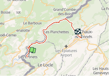

Length
19.4 km

Max alt
1161 m

Uphill gradient
1005 m
Km-Effort
32 km

Min alt
631 m

Downhill gradient
847 m
Boucle
No
Creation date :
2014-12-11 00:00:00.0
Updated on :
2014-12-11 00:00:00.0
7h39
Difficulty : Unknown

FREE GPS app for hiking
 SityTrail
IGN / Geographical institutes
SityTrail Plus
The world is yours!
About
Trail Other activity of 19.4 km to be discovered at Neuchâtel, Unknown, Le Locle. This trail is proposed by bffcuc.
Positioning
Country:
Switzerland
Region :
Neuchâtel
Department/Province :
Unknown
Municipality :
Le Locle
Location:
Les Brenets
Start:(Dec)
Start:(UTM)
325925 ; 5215220 (32T) N.
Comments